viewof select_W1B = Inputs.select(["All", "Germany", "France Metropolitan", "France Antilles", "Ireland", "Turkey", "Tunisia"], {label: "Survey sample"})
viewof stu_sel_W1B = Inputs.text({label: "Student's ID", placeholder: "882osw6mv496", value: respListUnique[0]})
viewof nextResp_W1B = Inputs.button([
["Répondant précedent", value => value == 0 ? respListUnique.length- 1: value - 1],
["Répondant suivant", value => value >= respListUnique.length-1 ? 0 : value + 1],
], {value: respListUnique.findIndex(d => d === stu_sel_W1B), label: ""})
// ---------------------------------------------------------------------------
// MAP
// ---------------------------------------------------------------------------
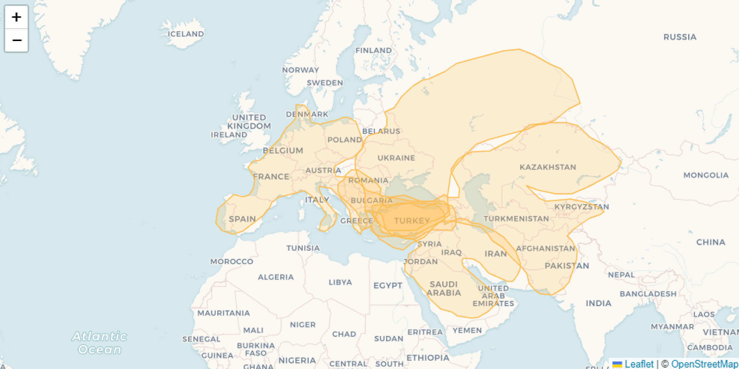
map_W1B = {
// Set highlight
function highlightFeature(e) {
var layer = e.target;
layer.setStyle({
weight: 1,
color: '#ba66a9',
dashArray: '',
fillOpacity: 0.5
});
}
// Reset Highlight
function resetHighlight(e) {
layer.resetStyle(e.target);
}
// OnEach featur
function onEachFeature(feature, layer) {
layer.bindPopup(function (Layer) {
return "<b><i>Region drawn : </b></i>" +
Layer.feature.properties.ID_geom + "<br>" +
"<b>Reg name : </b>" + Layer.feature.properties.E1903_map_rgname + "<br>" +
"<b>Reg name (fr) : </b>" + Layer.feature.properties.E1903_map_rgname_lab_fr + "<br>" +
"<b>Reg name (en) : </b>" + Layer.feature.properties.E1903_map_rgname_lab_en + "<br>" +
"<b>Reg scale : </b>" + Layer.feature.properties.E1903_map_rgname_scale + "<br>" +
"<b>Reg parent : </b>" + Layer.feature.properties.E1903_map_rgname_parent1_en + "<br>" +
"<br>" +
"<b><i>Respondent : </b></i>" + Layer.feature.properties.X0001_met_respID_aut + "<br>" +
"<b>Sex : </b>" + Layer.feature.properties.sex + "<br>" +
"<b>Country : </b>" + Layer.feature.properties.country + "<br>" +
"<b>Fields of study : </b>" + Layer.feature.properties.field + "<br>" +
"<b>Level of study : </b>" + Layer.feature.properties.levels + "<br>" +
"<b>Nationality : </b>" + Layer.feature.properties.iddoc + "<br>" +
"<b>Opinion of EU :</b>" + Layer.feature.properties.opiEU
})
layer.on({
mouseover: highlightFeature,
mouseout: resetHighlight,
});
}
// MAP
const container = yield htl.html`<div style="height: 50vh; width: 50vh">`;
const map = L.map(container);
const layer = L.geoJSON(macro_resp_W1B, {
onEachFeature: onEachFeature,
style: {
fillOpacity: 0.2,
color: "#FFBC50",
weight: 1.5}
}).addTo(map);
// fit map to geom bounds
map.fitBounds(layer.getBounds(), {maxZoom: 9});
// Tile Layer
L.tileLayer("https://{s}.basemaps.cartocdn.com/light_all/{z}/{x}/{y}{r}.png",
{attribution: '© <a href="https://www.openstreetmap.org/copyright">OpenStreetMap</a> contributors © <a href="https://carto.com/attributions">CARTO</a>',
subdomains: "abcd",
maxZoom: 10
}).addTo(map);
}
// ---------------------------------------------------------------------------
// TABLE
// ---------------------------------------------------------------------------
// ---------------------------------------------------------------------------
// DATA
// ---------------------------------------------------------------------------
macroreg_students_W1B = FileAttachment("../data/BDG_4326_carto.GeoJSON").json()
macroreg_W1B = geo_W1B.simplify(macroreg_students_W1B, {k:0.2})
macroreg_sorted_W1B = geo_W1B.featurecollection(macroreg_W1B.features.sort((a, b) => d3.descending(a.properties.area_3857, b.properties.area_3857)))
macroreg_filtered_W1B = {
let filtered = select_W1B == "All" ? macroreg_sorted_W1B : geo_W1B.filter(macroreg_sorted_W1B, (d) => d.country == select_W1B)
return geo_W1B.rewind(filtered)
}
macro_resp_W1B = geo_W1B.filter(macroreg_filtered_W1B, d => d?.X0001_met_respID_aut == respListUnique[nextResp_W1B])
respList = macroreg_filtered_W1B.features.map(d => d.properties.X0001_met_respID_aut)
respListUnique = [...new Set(respList.filter(value => value !== undefined))]
// ---------------------------------------------------------------------------
// LIBS
// ---------------------------------------------------------------------------
geo_W1B = require("geotoolbox@2.0.3")Exploration de toutes les régions dessinées par les étudiants